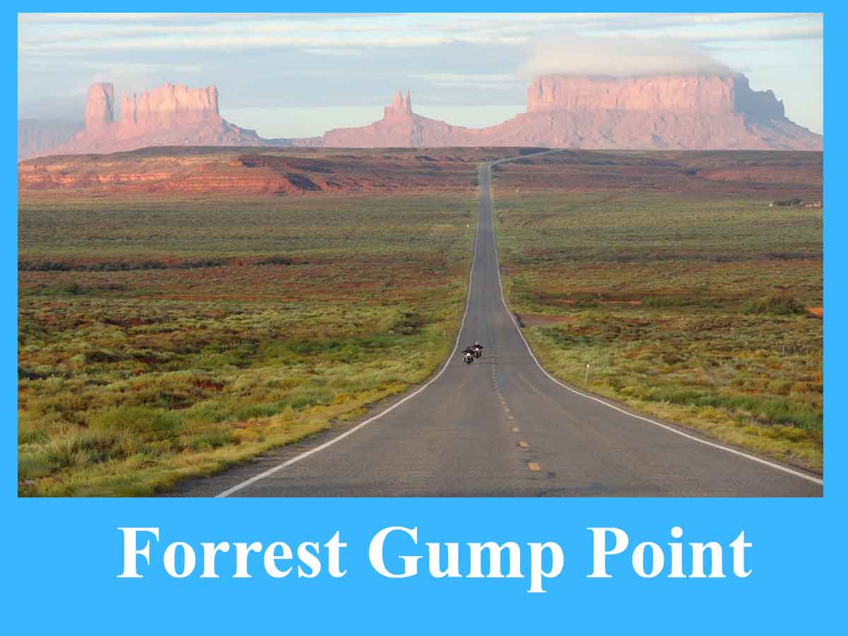
About Forrest Gump Point
Located in Monument Valley, Utah, behind Forrest Gump Point is one of the most iconic scenic points in the states. This site gained fame after it was shown in the 1994 Oscar-winning movie Forrest Gump. It is where Tom Hanks’ character, Forrest Gump, stops running after crossing the country several times and decides to return home. This stunning place gives you a panoramic view of Monument Valley’s soaring rock formations and the straight road extending into the distance, making it a picture-perfect backdrop for fans of photography and movie-goer.
Getting to Forrest Gump Point & Location
Forrest Gump Point, along U.S. Highway 163 in southern Utah, near the Arizona border. This is #37.101649, -109.990675. It’s about 13 miles north of Monument Valley Navajo Tribal Park. It can be accessed by driving up Highway 163 from either Kayenta, Arizona, or Mexican Hat, Utah, to Forrest Gump Point.
The closest major airport is in Page, Ariz., 125 miles away. From Las Vegas it’s about a 6-hour drive, and if you’re coming from Salt Lake City it will take you about 7 hours. Roadside parking is allowed though care should be taken since the highway is alive with passing traffic.
Why is Forrest Gump Point Popular?
It is so famous because of its appearance in the movie Forrest Gump, but it is actually much more than that. As eye-catching as the raw landscape of Monument Valley, the freeway road paved into the mesas ahead reflects a curious epic splendor. Travelers and photographers come here to capture the iconic scene, or just to take in the entrancing desert beauty. It is now among the most photographed places in the American Southwest.
When is the Best Time to Visit Forrest Gump Point?
The best time to check out Forrest Gump Point is during sunrise and sunset when the soft light brings out the reddish colors of Monument Valley’s rock formations. I suggest spring (March-May) and fall (September-November) because the temperatures are the most comfortable. The summer boasts scorching temperatures over 100°F (38°C), whereas the winter might see some snow from time to time, giving it a beautiful visual palette.
What to Know & Tips for Visiting Forrest Gump Point
- Breathtaking views, no cover.
- There are no formal signs indicating Forrest Gump Point, use GPS coordinates to find it.
- It is an active road which still has traffic, so be mindful when snapping photos.
- Monument Valley’s climate is dry, so bring plenty of water.
- Then you can know when the lighting is best, which is usually on the morning and evening.
- Be mindful of Navajo culture since this is Navajo Nation land.
Attractions near Forrest Gump Point
- Monument Valley Navajo Tribal Park (13 miles away) Famous for its stunning red rock formations and scenic drives.
- Mexican Hat Rock (10 miles away) – A striking rock formation that looks like a Mexican hat.
- Goosenecks State Park (30 miles away) — Features stunning vistas of the winding San Juan River.
- Valley of the Gods (25 miles)—A more remote but no less beautiful alternative to Monument Valley.
- Moki Dugway (35 miles away) – A heart-pounding steep drive with stunning views of the desert landscape.